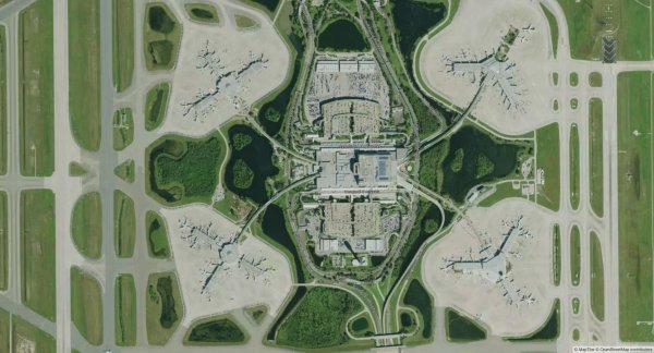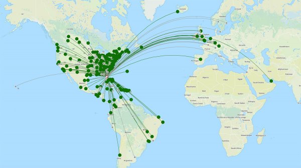
Being the busiest airport in Florida, Orlando International (MCO) welcomes thousands of flights every month. Find your way at the airport with our map and guide.
Map & downloads Airlines & Terminals Car rental Flight deals Parking

Orlando International Airport is situated about ten kilometers southeast of downtown Orlando and is the main airport in Florida. The airport is also a key hub for major American carriers such as Southwest Airlines and JetBlue Airways.
The airport in Orlando is one of the largest in the country, and is divided into two main terminals – Terminal A and Terminal B. There is also an additional Terminal C that recently opened to accommodate growing passenger numbers. At the top of the page you can find a map with the location of each terminal.
Terminal A: This terminal is primarily used by airlines like JetBlue Airways, Frontier Airlines and Spirit Airlines. Gates in Terminal A are numbered from 1 to 29, and 100 to 129.
Terminal B: Terminal B hosts airlines like Southwest Airlines, American Airlines and Delta Air Lines. The gates in Terminal B range from 30 to 59, and 70 to 99.
Terminal C: The newest addition, Terminal C, is designed to handle a mix of international and domestic flights, with airlines like Aer Lingus and Emirates. Gates here are numbered from 230 to 245.
When it comes to dining at the airport, Orlando International has a lot to offer. At the airport you can find both quick meal and sit down options, making sure there is something for everyone. To learn more and find the location of each restaurant we recommend that you have a look at the official airport website by following the link below.
Food map Orlando International Airport
Like most major airports, Orlando International Airport has a dedicated rental car center where you can find major rental companies such as Hertz, Avis, Budget and Enterprise. The pick-up and rental car return is located right by the main terminal, making it easy to reach for all travelers.













Orlando, Florida, USA
Latitude & longitude coordinates: 28.432177,-81.308301
