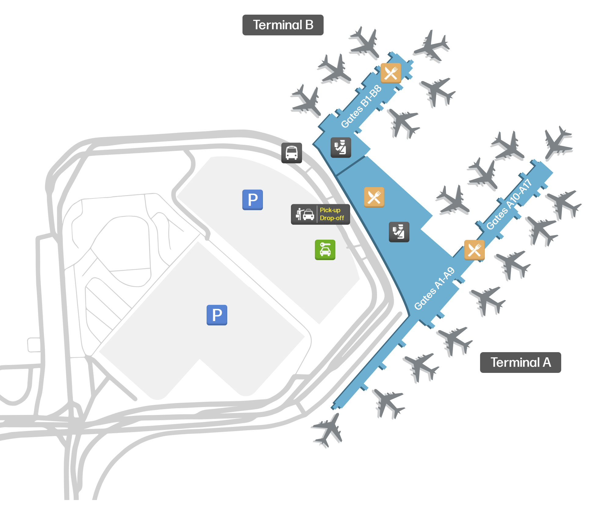
San Antonio Airport is a major international airport in Texas. Use our map to find your way around and get transportation.
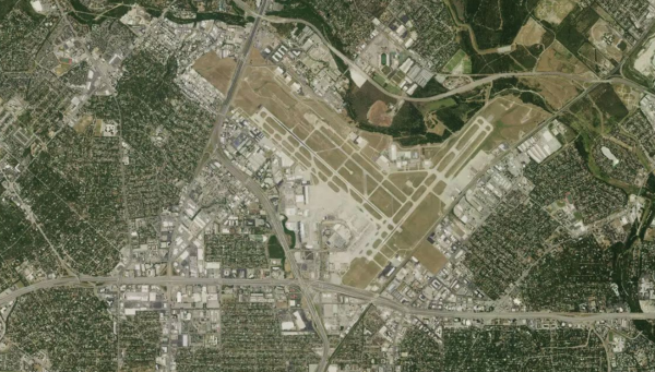
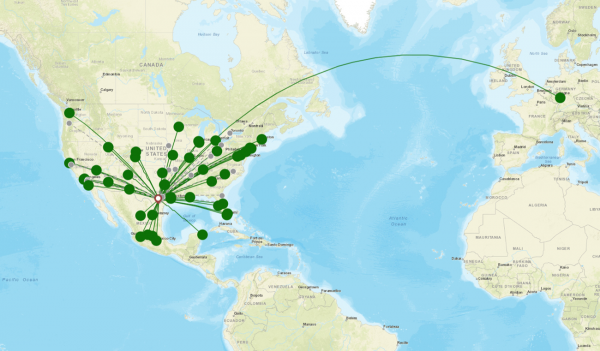
San Antonio International Airport (SAT) is the main airport serving San Antonio, Texas. It services mainly domestic destinations across the United States, but also services flights to Mexico and Germany.
Located approximately 8mi (13km) north of Downtown San Antonio, it is the 44th
busiest airport in the United States by passenger traffic.
San Antonio Airport: Terminal and gate map
The airport consists of two terminals, Terminal A and Terminal B.
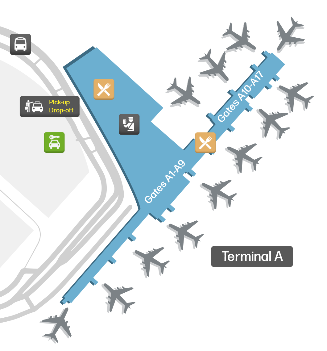
Terminal A: Handles all flights for international carriers. It is the larger of the two terminal buildings. Most of the airlines operating at the airport use Terminal A. Gates A are numbered in sequential order (A2-A17).
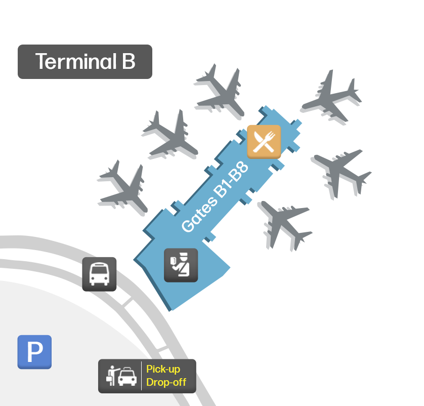
Terminal B: It is the smaller of the two terminals. It contains
Gates B (B1A-B9).
There is one main pick-up and drop-off zone for passengers arriving and departing from the terminals. Each terminal has its own check-in and security areas. You can use our map at the top of this page to view the complete terminal layouts.
Dining, shops and lounges at San Antonio Airport
There is a wide range of dining options at the airport. They can be found before and after the security checkpoints.
Terminal A includes cafes, casual dining, bakeries, desserts, sit-down restaurants and several bars and licensed establishments.
Terminal B includes a food court in the waiting area for Arrivals. There are also many high-quality restaurants featuring hamburgers, steak and Mexican cuisine.
Shops at the airport are primarily located throughout the mezzanine area and near the boarding gates. They include outlets featuring electronics, newsstands, bookstores, fashion, mobile and specialty retail.
Lounges at the airport include a USO lounge near the check-in area for Departures in Terminal B. There is also a United Club lounge in Terminal B, next to Gate B3. A chapel is located next to the check-in area of the Departures Hall, also in Terminal B.
Find transportation from the airport: Public transit, taxi, rental cars, parking
Public Transport: VIA bus route 5 operates daily and takes passengers from the airport to downtown San Antonio. Transit time is approximately 30 minutes. The bus stop can be found on the far West end of Terminal B, outside of the Arrivals area, on the outer curb.
Taxi/Rideshare: Taxi cabs and rideshare designated pickup locations are available outside of Terminal A.
Car rentals: Car rental counters are located at the Consolidated Car Rental Facility. It can be found by reaching the Mezzanine Level of Terminal B and taking the SkyBridge across the roadway below.
Parking: Many parking options are available at the airport. These include valet parking services, priority terminal access, long-term parking garages and economy parking with shuttle bus services.

