Map of Ontario International Airport (ONT) – Gates and Terminals

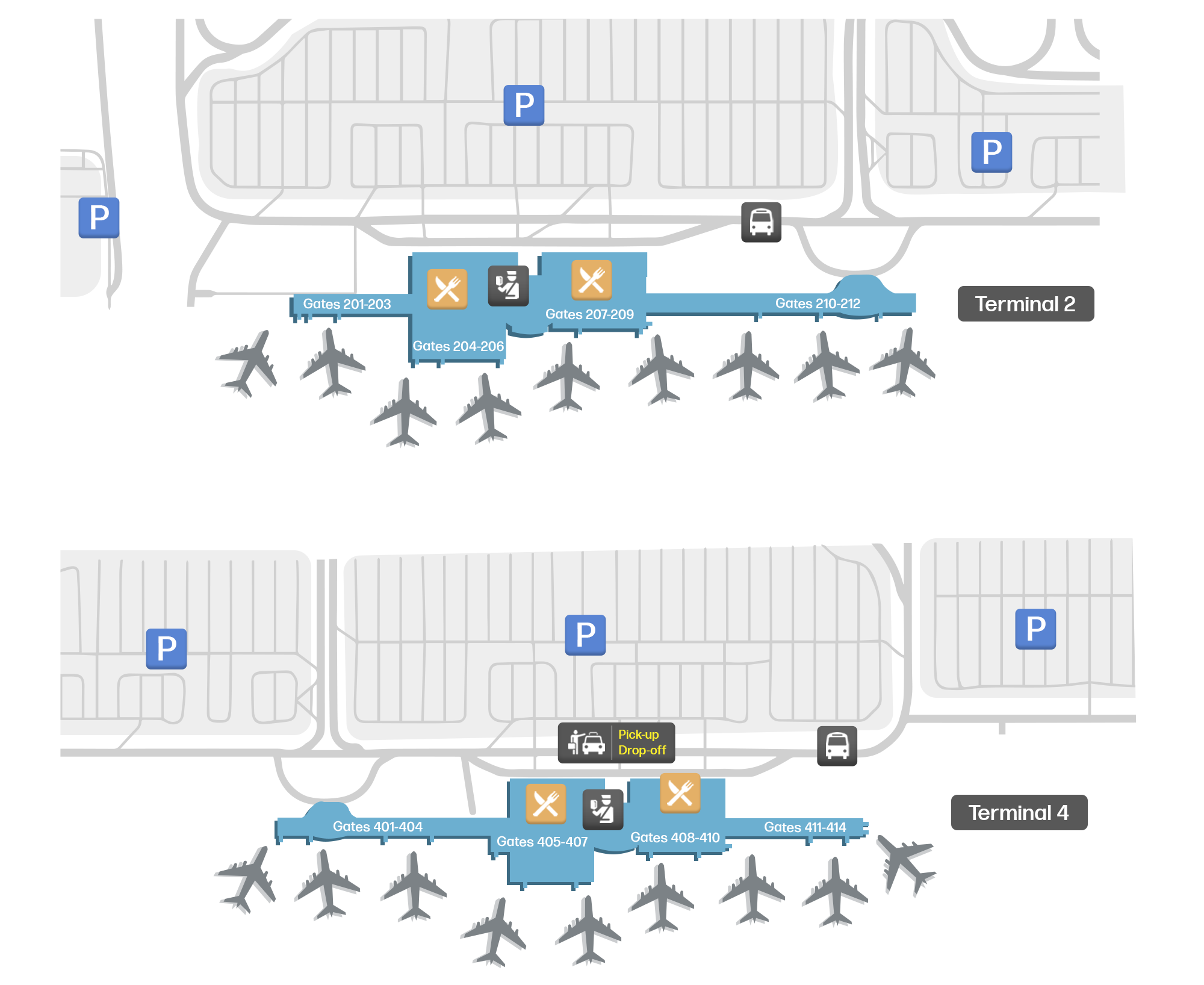
Ontario International Airport is one of the main hubs in California. Here is a map of its two terminals.

Map & downloads Airlines & Terminals Car rental Flight deals Parking

Ontario International Airport, United States map
Download as PDF
Download as PNG
Map icons:
Restaurant icon Food
Bus icon Bus
Train icon Train
Security icon Security
Parking icon Parking
Car rental icon Car rentals
Hotel icon Hotel

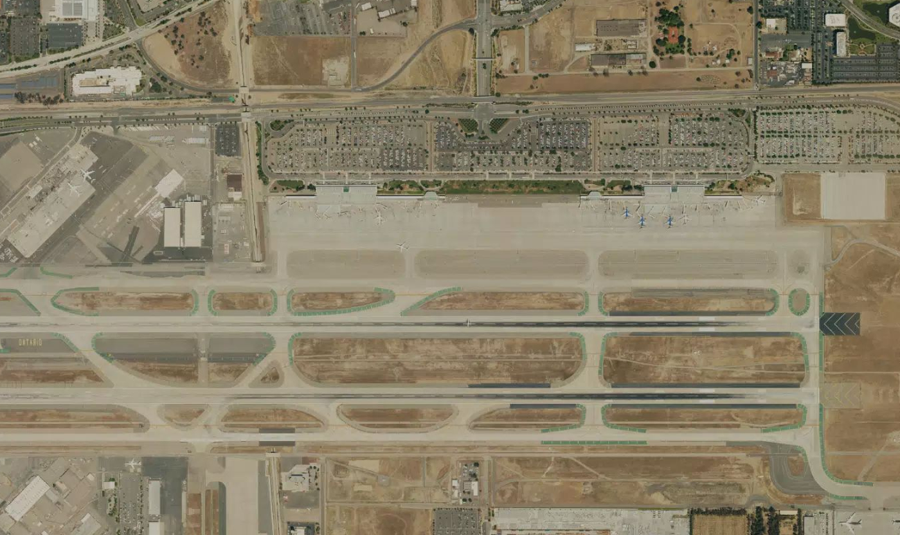
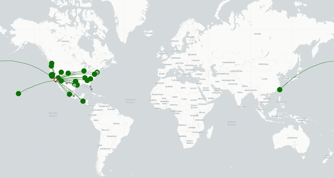
Located about two miles east of downtown Ontario and 31 miles east of downtown Los Angeles, Ontario International Airport (ONT) is one of the main hubs in California. A total of 12 commercial airlines currently operate here. These offer flights to about 25 destinations in the USA, Latin America, and even Asia, with a direct route to Taipei, the capital of Taiwan. Back in 2023, ONT handled over 6.4 million passengers, re-establishing itself as a main hub in the area.

Ontario International Airport Terminals and Gates Map

Ontario International Airport is divided into two terminals. These are located next to each other and connected by an airport shuttle, which also stops at the rental car center. The shuttle operates 24 hours and departs roughly every 5-20 minutes. Between 12:30 am and 3:00 am, departures are less frequent.

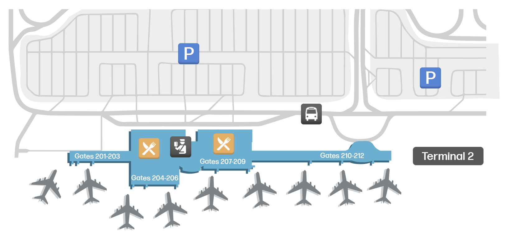
  • Terminal 2: This terminal is used by most airlines and is home to 12 gates numbered 201 - 212.

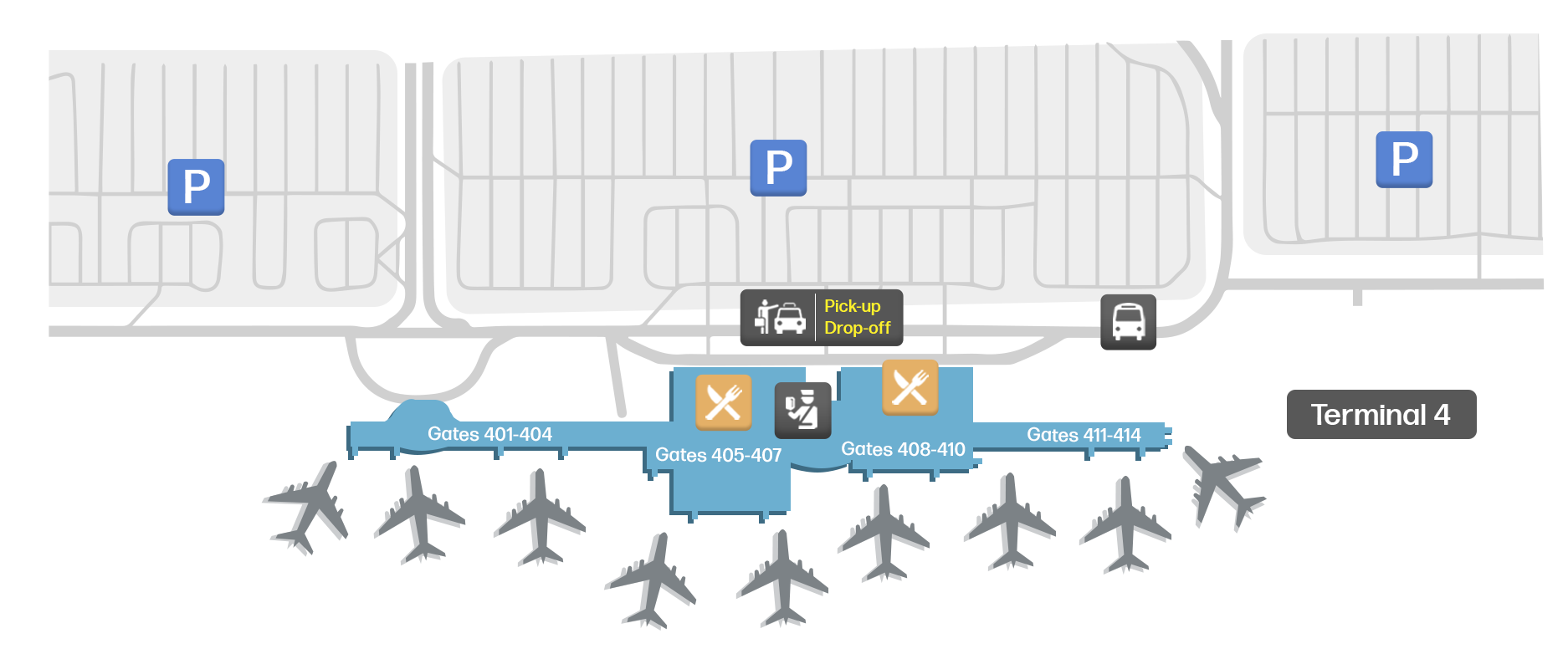
  • Terminal 4: Terminal 4 is used by American Airlines, Hawaiian Airlines, and Southwest. Here, passengers will find 14 gates numbered 401 - 414.

Hotels at Ontario International Airport

Unfortunately, there are no sleeping pods or transit hotels inside the terminals. However, passengers can reach several accommodations with a 20-30 minute walk. Some hotels also provide a shuttle service to the airport.

Services at Ontario International Airport

Ontario Airport is home to several eateries, including renowned fast-food chains such as Subway. Here, you will also find some stores selling all sorts of products, as well as lounges for those looking for some extra comfort. Both terminals are equipped with nursing rooms and pet relief areas.

Traveling To and From Ontario International Airport

Below are some popular transportation options to travel to and from ONT:

  • MetroLink: Passengers can head to this airport via the MetroLink San Bernardino Line, stopping at the Rancho Cucamonga Station. From here, they’ll be able to access the ONT Connect shuttle, which heads directly to both terminals. The shuttle is free with a valid Metrolink ticket.

  • Bus: Plenty of buses connect ONT to several destinations in California. You can access a full list on Ontario Aiport’s official website.

  • Car Hire: A rental car center can be found to the east of terminal 4. This is connected to both terminals by a free shuttle.

  • Car Sharing: Apps such as Uber, Lyft, Opoli, and Wingz also operate at the airport. A trip to downtown Ontario costs an average of $15-20 while heading to Los Angeles will cost you $80-100.

  • Taxi: Ontario International Airport partners with Bell Cab. Taxis can be found outside both terminals.

Those arriving here in their own car can choose one of the many parking lots on the airport grounds. You can check the airport’s official website to check current fares.

Ontario International Airport airlines

Terminal: 2
United logo
United
155 flights next month
4 destinations
Delta logo
Delta
208 flights next month
3 destinations
Alaska Airlines logo
Alaska Airlines
108 flights next month
3 destinations
China Airlines logo
China Airlines
29 flights next month
1 destination
AVIANCA logo
AVIANCA
12 flights next month
1 destination
JetBlue logo
JetBlue
flights next month
1 destination
Terminal: 4
Southwest logo
Southwest
820 flights next month
12 destinations
American Airlines logo
American Airlines
285 flights next month
3 destinations
Hawaiian Airlines logo
Hawaiian Airlines
21 flights next month
1 destination
Starlux Airlines logo
Starlux Airlines
flights next month
1 destination

Ontario International Airport location

Find out the location of Ontario International Airport.

Satellite view of Ontario International Airport
Satellite view of Ontario International Airport. Click to enlarge.
Ontario Airport destination map
Ontario Airport destination map (February 2025). Click to enlarge.

Other airports in USA

John F. Kennedy
Los Angeles
LaGuardia
Newark Liberty
Dulles
Dallas Fort Worth
Harry Reid
Phoenix Sky Harbor
San Francisco
Charlotte Douglas
Miami
Orlando
Seattle-Tacoma
Boston Logan
Minneapolis-Saint Paul
Tampa
Denver
San Diego
Ronald Reagan Washington National
Chicago Midway
Salt Lake City
Philadelphia airport
Chicago O'Hare
Hartsfield–Jackson Atlanta
Detroit Metro
George Bush Intercontinental
FLL
Indianapolis
Charlotte County-Punta Gorda
Charleston Afb
Sacramento
Honolulu
Louis Armstrong New Orleans
St. Pete–Clearwater
Pittsburgh
Kansas City
Sarasota Bradenton
Orlando Sanford Intl
Dallas Love Fld
Raleigh–Durham
Southwest Florida
Saint Louis
Portland
Hobby
Baltimore Washington
Austin-Bergstrom
Nashville
Jacksonville
San Antonio
Bradley
Ted Stevens Anchorage
Port Columbus
Metropolitan Oakland
Cleveland Hopkins
Norman Y Mineta San Jose
Myrtle Beach
Palm Beach
Phoenix–Mesa Gateway
Norfolk
John Wayne Arpt Orange Co
Theodore Francis Green State
Savannah Hilton Head
Richmond
Louisville
General Mitchell
Burbank Glendale Pasadena
Memphis
Gerald R Ford
Eppley Afld
Buffalo Niagara
Palm Springs
Mc Ghee Tyson
Tweed-New Haven
Albuquerque Sunport
Kahului
Eglin Afb
Des Moines
Syracuse Hancock
Will Rogers World
Albany
Greater Rochester
Greenville-Spartanburg
Boise Air Terminal
Birmingham
Asheville Regional
NW Arkansas Regional
Westchester Co
Reno Tahoe
South Bend Rgnl
Long Beach
Tulsa
Portland Jetport
Pensacola Rgnl
Key West
Gallatin Field
Kona
Harrisburg
Ad
© 2025 Westcoast Digital